Navigating Denali National Park: A Comprehensive Guide to Alaskas Premier Wilderness Amid Infrastructure Challenges

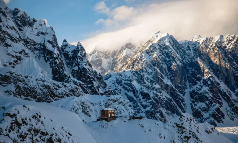
The vast expanse of Denali National Park and Preserve, encompassing over six million acres of pristine Alaskan wilderness, continues to draw hundreds of thousands of visitors annually despite ongoing logistical and infrastructure challenges. Established initially in 1917 as Mount McKinley National Park before being significantly expanded and renamed in 1980 under the Alaska National Interest Lands Conservation Act (ANILCA), the park is centered around the towering massif of Denali. Standing at 20,310 feet, it is the highest peak in North America. Today, navigating this sprawling subarctic ecosystem requires careful planning, particularly as park management grapples with significant geological shifts along the park’s singular access route, forcing travelers to adapt traditional itineraries.
Chronology of the Park Road Closures and Infrastructure Challenges
The lifeline of Denali National Park has historically been the 92-mile Denali Park Road, a narrow, mostly unpaved route that provides the sole vehicular penetration into the deep interior. For decades, narrated tour buses and hop-on, hop-off transit buses traversed the entire length of the corridor, offering visitors unparalleled access to wildlife viewing, remote trailheads, and deep-wilderness vistas.
However, the dynamic and fragile nature of the Alaskan landscape has severely disrupted these transit patterns. The crisis centers around Pretty Rocks, a section of the park road located near mile 45. The area features a massive rock glacier—a mixture of rock fragments and ice—that has begun moving at an unprecedented rate due to warming temperatures and thawing permafrost.
Chronologically, the instability at Pretty Rocks escalated significantly in the late 2010s. By 2021, movement rates accelerated dramatically, causing sections of the road to drop by several feet per day, rendering it impassable for vehicular traffic. The National Park Service (NPS) was forced to close the road beyond mile 43. Subsequent engineering assessments and continuous monitoring confirmed that traditional road repair methods would be insufficient for a permanent fix. Consequently, the NPS authorized the construction of a 420-foot bridge spanning the active slide area, a complex engineering feat designed to bridge the unstable slope. While construction crews work toward a projected completion timeline aimed at reopening through-traffic in the coming years, current visitors must navigate a truncated park experience where all public and commercial vehicle traffic turns around at mile 43.
Current Access and Transportation Strategies
With the inner reaches of the park road temporarily severed from vehicle traffic originating at the entrance, visitor logistics have adapted. Travelers seeking a glimpse of the park road’s lower elevations can utilize the complimentary courtesy shuttle system operated by the National Park Service. This service runs between the Denali Visitor Center and the Savage River area, situated at mile 15.
For those desiring a more active engagement with the landscape, non-motorized travel offers an effective alternative. Independent concessionaires, such as Bike Denali located approximately one mile outside the park entrance, rent specialized bicycles equipped to handle the gravel terrain. Cyclists are permitted to ride beyond the mile 43 closure point, weather and road conditions permitting, allowing for deep-wilderness exploration free from motorized traffic noise. Additionally, private motorists are permitted to drive their personal vehicles as far as the Savage River parking area during peak summer seasons, though parking availability is strictly limited and spaces fill up rapidly during peak morning hours.
Encountering North America’s Tallest Peak
Expectations regarding visual access to Denali itself often require managed patience from travelers. Due to the topographical layout of the surrounding terrain and the immense height of the mountain, the peak is entirely invisible from the immediate park entrance area. Visitors must journey to at least mile 9 of the park road before the elevation angle provides a clear line of sight to the summit. For hikers seeking an elevated vantage point, the Mountain Vista trail, located near mile 12, provides a structured route with sweeping views of the Alaska Range.
Meteorological conditions further complicate mountain viewing statistics. Park officials note that Denali generates its own weather patterns, leaving the peak completely obscured by clouds approximately two-thirds of the time during the peak summer tourist season. Visitors who fail to spot the mountain from within the park boundaries frequently find alternative viewing opportunities along the Parks Highway, where several well-marked waysides offer distant vistas. Furthermore, passengers traveling via the Alaska Railroad often report clear sightings of the peak as the rail line traverses the surrounding valleys.
Hiking Opportunities and Safety Protocols
Beyond the park road, Denali offers a diverse array of hiking experiences ranging from developed boardwalk trails to rigorous backcountry traverses. Popular established routes include the Savage River and Savage Alpine trails, which provide accessible introductions to the alpine tundra ecosystem. For those seeking aquatic scenery, the Triple Lakes Trail extends over several miles through dense boreal forest, where hikers frequently spot active beaver lodges and dams.
A unique aspect of Denali National Park is its liberal backcountry policy, which permits visitors to hike completely off-trail. Travelers may disembark from courtesy shuttles at designated pullouts along the accessible portion of the park road and explore the tundra independently. However, this freedom comes with strict safety mandates. The park is home to significant populations of grizzly bears and wolves, necessitating rigorous precautions.
The National Park Service and local concessionaires strongly enforce safety protocols, chief among them the carriage of bear spray. Rentals are readily available at the Alaska Geographic store adjacent to the Denali Visitor Center. Park rangers emphasize that proper education on wildlife encounters is critical for all backcountry users. Rangers maintain a daily presence, offering informational sessions on bear safety and leading scheduled ranger-interpreted hikes both on and off established trails.
Working Canines: The Denali Sled Dog Tradition
Denali holds the distinction of being the only national park in the United States that continues to employ a working kennels of sled dogs. Established during the early years of the park’s history, the sled dog program serves a vital operational purpose. During the long winter months when deep snowpacks and extreme cold render motorized vehicles unreliable or damaging to the tundra, park rangers utilize dog teams for winter patrols, wildlife research, and maintenance transport.
Throughout the summer season, the kennels remain a primary attraction for park visitors. Public demonstrations are held two to three times daily, during which handlers explain the breeding, training, and operational history of the working dogs. Access to the kennels is available either via a walking path originating near the park entrance or through the park’s complimentary shuttle service.
Commercial Tours and Peripheral Adventures
Because the inner park road remains restricted, a robust industry of commercial adventure operators has flourished along the immediate eastern boundary of the national park, primarily centered around the Glitter Gulch commercial strip near Healy. These operators offer a wide spectrum of motorized and non-motorized excursions that complement a national park itinerary.
Equestrian tours, operated by companies such as Denali Horseback Tours, take visitors into the foothills overlooking the park boundaries. These excursions offer panoramic vistas of the Nenana River valley and the outer ranges without the acoustic and environmental footprint of motorized transport. Conversely, for travelers seeking high-octane experiences, operators like Denali ATV Adventures provide guided off-road vehicle tours through the rugged terrain flanking the park’s borders.
Water-based recreation is another cornerstone of the regional visitor experience. The Nenana River, which carves a dramatic canyon along the eastern perimeter of the park, serves as the primary venue for whitewater rafting. Family-owned outfitters such as Denali Raft Adventures navigate both the churning rapids of the lower canyon and the calmer, braided channels upstream, accommodating a wide range of thrill-seeking thresholds.
For travelers seeking deep-interior access despite the road closure, specialized concessionaires possess the requisite National Park Service permits to conduct guided backcountry expeditions within the park boundaries. Companies such as Alaska Alpine Adventures offer custom backpacking and mountaineering itineraries, though these programs require significant physical conditioning and advanced planning due to the remote nature of the terrain.
Economic and Managerial Implications
The partial closure of the Denali Park Road has introduced complex economic and operational dynamics for gateway communities and park management alike. Local tourism economies, which rely heavily on multi-day itineraries and deep-park transit tours, have had to restructure marketing efforts toward boundary-based adventures, flightseeing tours, and short-range excursions. Meanwhile, the National Park Service continues to balance visitor demand with long-term infrastructure resilience, as climate-driven permafrost degradation poses ongoing challenges to infrastructure preservation across subarctic protected areas. As engineering solutions progress at Pretty Rocks, park officials maintain a phased approach to reopening, ensuring that ecological preservation remains prioritized alongside public access.